Archaeological Sensitivity Mapping
 Jonathan Last
 Sandy Kidd
Developing a methodology for understanding where future significant discoveries may be made.
The planning background
Since 1990 the English planning system has made provision for the assessment of archaeological remains in any location subject to a planning application in order to enable informed decisions on development consent. The present National Planning Policy Framework (NPPF) emphasises the positive contributions the historic environment can make to sustainable development and recognises that heritage assets, a subset of which are archaeological, should be either preserved in situ or recorded prior to harm in order to advance understanding, for the benefit of present and future generations.
This developer-funded system has been a great success story, contributing to the wellbeing of people and communities, boosting public engagement with the historic environment, and highlighting local distinctiveness.

In 2020 a government white paper proposed planning reforms whereby areas of land could be pre-allocated for development. This would have put an onus on providing more upfront archaeological information at an earlier, strategic level of spatial planning, in particular the Local Plans produced by local authorities, implying a need for existing evidence to be used more systematically in order to identify locations of greater and lesser potential for significant archaeology.
An area-based approach
Although the white paper’s land categorisation has not been taken forward, an area-based approach to mapping potential could still be a useful strategic planning tool and help us to understand the likely impacts of other forms of large-scale landscape change such as afforestation or ‘rewilding’.
Recent archaeological policy initiatives, including Historic England’s project with the Chartered Institute for Archaeologists’ ‘21st Century Challenges’, recognise the importance of improving the information available when the principle of development is considered.
Making better use in planning of Historic Environment Record information and the wide range of other spatial data now available could help us reduce risk (both to archaeology and developers), tell better stories by promoting research and synthesis, and deliver wider public benefits, for example by taking better account of archaeology in design codes and green infrastructure.
Modelling archaeological potential
Historic England’s approach to archaeological sensitivity mapping, developed through a number of pilot studies, therefore aims to provide a broad methodology to ensure archaeological potential receives better and earlier consideration in plan-making, thereby providing greater levels of certainty at plan consent stage and helping local authorities to balance their dual responsibilities for protecting heritage and enabling growth.
We aim to to provide a broad methodology to ensure archaeological potential receives better and earlier consideration in plan-making. This will give greater levels of certainty at plan consent stage and helping local authorities to balance their dual responsibilities for protecting heritage and enabling growth.
Modelling archaeological potential
Historic England’s approach to archaeological sensitivity mapping, developed through a number of pilot studies, therefore aims to provide a broad methodology to ensure archaeological potential receives better and earlier consideration in plan-making, thereby providing greater levels of certainty at plan consent stage and helping local authorities to balance their dual responsibilities for protecting heritage and enabling growth.
Predicting where significant remains are likely to occur is, of course, far from straightforward, and archaeology will always remain in part a process of revealing the unknown. Indeed, the ‘excitement of discovery’ is seen as part of the public value of archaeology, referenced positively in Historic England’s Places and Wellbeing strategies. But there have long been efforts to reduce the likelihood of potentially costly unexpected discoveries by approaches that map, characterise, model or predict archaeological sensitivity, potential or risk (the choice of terminology is often dependent on the viewpoint of the user).
However, the lack of an established approach to such mapping reflects the varied nature of archaeological data, particularly the highly uneven distribution of current knowledge.
The blank zones on traditional archaeological distribution maps conflate areas which are believed (as far as possible) to be lacking in significant remains with areas about which little or nothing is known (pseudo-absences). Experience over the last thirty years has shown there are few large areas in England that are truly archaeologically blank but the character and density of remains varies considerably, as demonstrated by the English Landscapes and Identities (EngLaId) project.
We can therefore use the patterns of previous discovery to make evidence-based assessments of potential that attempt to understand where significant discoveries are more likely to be made in the future.
The outputs of such modelling need to look more like historic landscape characterisation, which assigns the entire landscape to a category based on extant historic character, i.e. there are no blank areas.
On the other hand, although historic landscape characterisation includes some time depth (maps of ‘previous character’) this is generally restricted to what can be inferred from post-medieval maps, and therefore provides little evidence for significantly earlier archaeological periods. Developing a form of characterisation for archaeological evidence (of all periods) would emphasise the deeper history of the landscape; remains may vary hugely in significance, survival/condition and visibility but very few areas will have zero archaeological potential.
From potential to sensitivity
However, whether we can develop a sufficient understanding of the character of the continuous archaeological record to determine in advance of development where the ‘hotspots’ are more likely to be, and thereby target investigation and conservation efforts accordingly, is only part of the question, since ‘sensitivity’ implies more than just modelling locations.
Our approach follows landscape assessment techniques in defining sensitivity as a combination of judgements of the value of an asset, or potential asset, and its susceptibility to a proposed or envisaged change.
The model has four components, the first two of which can be characterised as objective qualities of an asset:
- its presence (whether something is actually there)
- and condition (related to both the depth of stratigraphy and the burial environment).
The other two components are more contextual:
- significance, which may be related to criteria for national importance and/or current research priorities for an area
- and vulnerability/opportunity, which are linked because they both relate to the impact of a given change scenario.
None of these aspects of sensitivity is straightforward to analyse, but they can be approached in a systematic manner that goes well beyond a simple plot of Historic Environment Records data. The likelihood of assets of different type or period being present can be assessed by identifying areas that offer the same range of characteristics or affordances where such assets have been encountered in the past. (In this context ‘affordances’ being the qualities and attributes of a place or environment that provide opportunities for people or other organisms).
The likely condition of an asset, should one be present in a given area, can be estimated from soil characteristics and land-use history. Significance could be mapped by identifying areas with greater likelihood of producing assets of national importance, or potentially in the future by developing research frameworks that are map-based rather than purely textual. Finally, the sum of the different aspects of potential (presence, condition and significance) needs to be assessed in terms of vulnerability to the nature of the proposed landscape change.
Clearly the amount and quality of Historic Environment Record data in a given area will influence the usefulness of a model; those produced for our pilot studies have varied from quantitative estimates of the number of assets per square kilometre, where data is extensive, to simply mapping biases in the known data (such as the uneven distribution of previous investigations), where it is sparser.
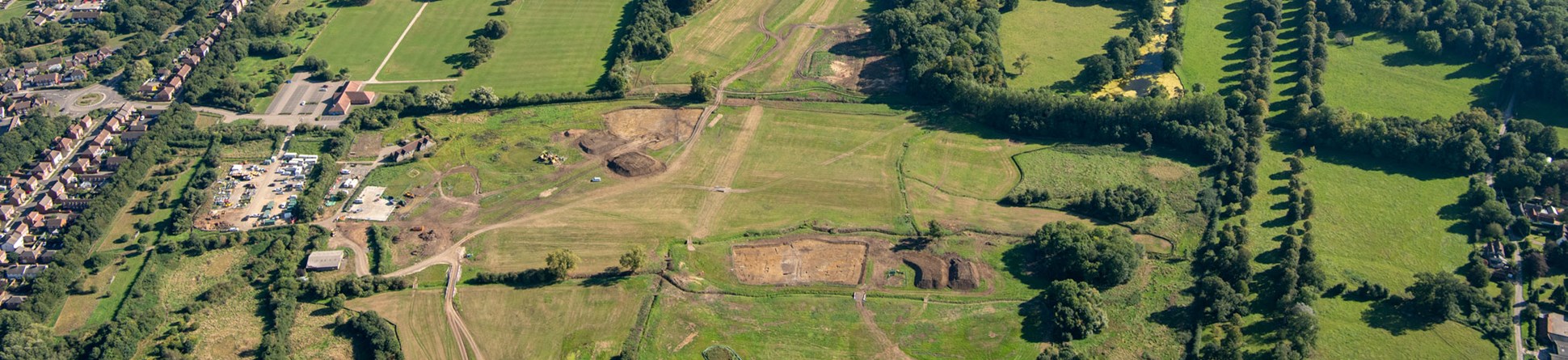
Any model might therefore identify areas where not enough is known to allow an informed judgement of potential but keys to improvement include the availability of large-area development-led fieldwork results, that can serve as detailed ‘case studies’ representative of a wider area, and systematic aerial mapping surveys, which provide a consistent baseline level of information.
The pilot studies undertaken in Buckinghamshire, Essex, East Yorkshire and Cumbria suggest that sensitivity models need to cover between about 100 and 300 square kilometres in order to gather sufficient data for pattern recognition without becoming unwieldy or conflating patterns across different landscapes.
While there is more to do to produce models that meet the objectives of being robust, easy to deliver and simple to understand, for example by using more sophisticated spatial analysis techniques, the work so far has demonstrated that such an approach is feasible at the scale of a local plan. It produces results that are more transparent than the application of ad-hoc expert judgement, though all models require verification by such expertise. Sensitivity mapping is a complement to, not a replacement for, established field evaluation techniques because it operates at a larger scale and lower resolution. However, in the context of net-zero policies better upfront assessments could improve the efficiency of evaluation exercises by reducing the outlay on fieldwork.
We hope the pilot studies will be seen as inspiration for further model-building that will help ensure the historic environment is fully considered when designing or managing future landscape change.
About the authors
- Name and role
-
- Name
-
Jonathan Last
- Title and organisation
- Landscape Strategy Adviser at Historic England
- Details
-
- Description
- Jonathan is a prehistorian and landscape archaeologist who has worked in various roles for Historic England (formerly English Heritage) since 2001. He is currently Landscape Strategy Adviser in the Archaeological Investigation team.

- Name and role
-
- Name
-
Sandy Kidd
- Title and organisation
- Team Leader Greater London Archaeological Advice Service at Historic England
- Details
-
- Description
- Sandy is the CIfA Registered Postholder for Historic England’s Greater London Archaeological Advisory Service which provides the capital’s archaeological planning advice and Historic Environment Record. Previously Sandy worked in local government archaeology in Buckinghamshire where he managed a comprehensive programme of urban and rural characterisation that informed local development plans.

Further information
Kidd S and Last J : ‘Archaeological Sensitivity Pilot Projects’ Historic England Research Reports Series (forthcoming).
Download in PDF Format
You can download this article along with the others in this issue as a PDF magazine.


