New Research Reveals Details of North Walsham's Past
Historic England research published today gives a fascinating insight into the history of North Walsham.

A rich and interesting history
More than 200 photographs from the 1920s to the present day were analysed as part of the research and show how the town has changed over the past 100 years.
Analysis of wooden timbers in key historical properties has shown how the buildings relate to North Walsham’s Great Fire of 1600.
The research was carried out by a team at Historic England to further understand the historical significance of the area within the North Walsham High Street Heritage Action Zone. The high street scheme, run in partnership by North Norfolk District Council and Historic England, aims to renew and revitalise the historic town centre.
North Walsham has a rich and interesting history, with more than 100 listed buildings (the highest number of any town in North Norfolk), mostly dating from the 18th and early 19th centuries. The Tudor market cross is a major local landmark.
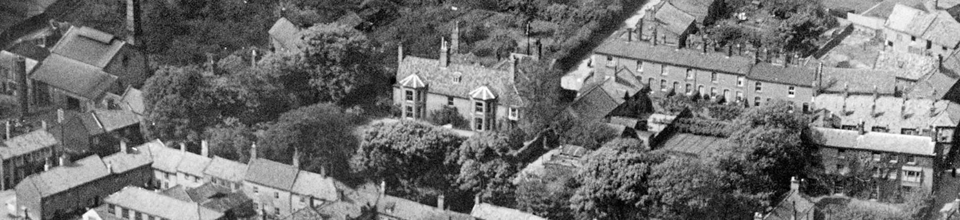
North Walsham from the air
The images analysed for the aerial photographic research were taken between 1928 and 2020, and show how North Walsham has changed over time. They include images of long-lost buildings that were demolished in the town’s redevelopment of the late 1960s to 1970s.
Many of the buildings seen in the 1928 and 1932 aerial photographs appear to match those represented on a tithe map of 1843. These photographs concentrate on the central and northern parts of the town centre and show some of the densely packed groups of buildings that once existed around the Market Place and the churchyard. Patterns of lanes and yards can be seen alongside glimpses of some of the people who lived and worked in the town.
North Walsham from the air
Highlights from the aerial investigation research
. B marks the entrance to a narrow blind alley. C (top right) marks the entrance to the Butchery. Detail of EPW021294 MAY-1928")

 side of the marketplace. Detail of EPW021294 MAY 1928")

. Detail of EPW021292 MAY 1928")

Dating wooden timbers in historic buildings
Tree-ring dating (dendrochronology) of wooden timbers was carried out at 26-27 Market Place and The Shambles, both Grade II listed 17th century properties, to discover whether any part of the buildings dated to before North Walsham’s Great Fire of June 1600.
The research showed that the timberwork in both buildings dates to after the fire of 1600, indicating the extent of the fire and the rebuilding that was needed afterwards.
What lies beneath
A ground penetrating radar (GPR) survey – a non-invasive method that allows detailed analysis of archaeology – was carried out by Phase SI on behalf of Historic England in five survey locations around Paston College and the Market Place in North Walsham.
While the majority of areas covered by the GPR survey were complicated by the presence of modern pipes, cables and other infrastructure, a variety of ‘anomalies’ have been identified which suggest basements to some of the properties. These confirm findings made by Historic England’s Architectural Investigators, particularly in relation to the Market Place.
In some instances, the interpretation of the cause of some anomalies was not clear and the full extent of the underlying feature may not have been determined, so further research is recommended for the future.


