Opportunities and Threats to the Maritime Environment
This section discusses how natural changes to the maritime environment and changes in human exploitation and understanding of the sea, allow greater opportunities to understand and study maritime heritage than ever before, but by the same token also pose greater threats to its integrity.
The marine and inter-tidal zones are dynamic and have always undergone natural environmental change and changing patterns of use and exploitation which are nothing new.
The coastline has always been subject to change, whether settlements and harbours have been eroded and lost to the sea, as at Dunwich in Suffolk, or have silted up and are now located inland, for example on the Sussex coast.
This process is continuous and is also affected by patterns of extreme weather which can reveal new wreck archaeology, result in damage to known wreck sites, or even create new forms of wreck.
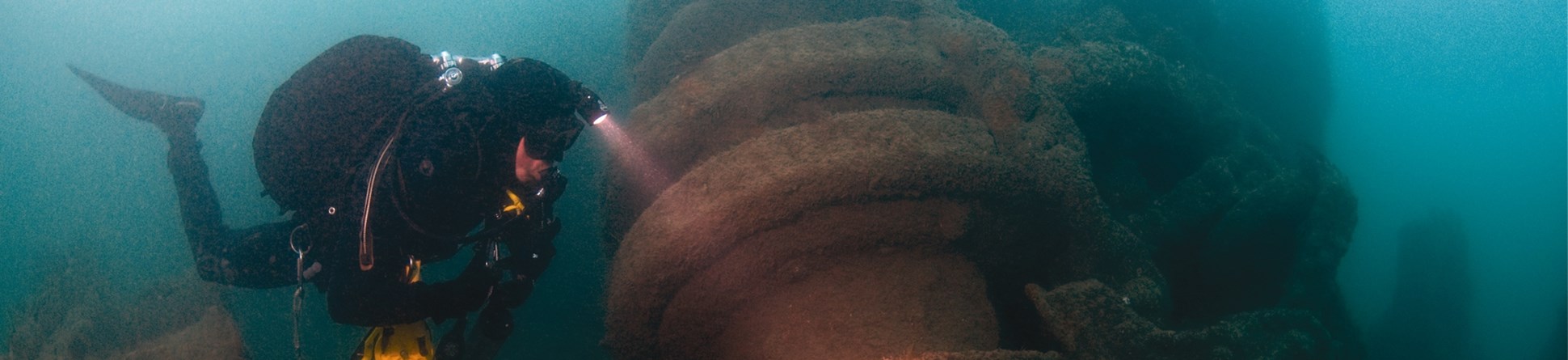
Coastal surveys and the techniques of marine archaeology lead to a greater understanding of the character of the local marine historic environment and how it is affected by these processes.
Responding to the unexpected
The patterns of changing exploitation of the seabed create new opportunities for discovery. For example, the wreck of the London (1665) was located and identified through archaeological assessment in advance of the London Gateway project which deepened the navigational channels in the Thames, resulting in the designation of the wreck and its continuing investigation.
In the marine planning system, new forms of construction at sea in the form of offshore renewables (windfarms) have the potential to impact on archaeology, but by the same token, can bring to light new archaeology and increase our understanding of what lies beneath the sea.
In a similar vein, individual climate events such as continuing storms of early 2014 can have an impact on local beaches, revealing wrecks that have rarely or never been seen before. These are often reported by members of the public, allowing us to enhance our records and identify wrecks for further research or potential protection.
Such wrecks, or other historic seabed or shoreline features such as submerged forests, can also come under threat. These threats may be environmental, for example, the erosion of a protective sand cover also exposes ship timbers on a wreck to the same forces of erosion.
Despite the positive impacts of public enthusiasm for maritime heritage, there are negative sides to human interest in shipwreck. Human impacts, from vandalism to theft of artefacts or the non-disclosure of removed artefacts from a shipwreck, are also a threat.
If objects are removed from shipwrecks without proper archaeological recording their context is lost and this lessens our understanding of these wrecks, while less is left for visiting divers to enjoy. These constitute heritage crimes and Historic England works closely with the Receiver of Wreck in order to educate and inform the public on maritime heritage issues.

What we can do
We can care for maritime archaeology in a number of ways. At Historic England we vary our approach according to the needs of each site that are clearly identified in a site- specific Conservation Management Plan.
Besides coastal survey and marine environmental assessments, photographic and documentary recording allows us to monitor changes to local archaeology and to identify individual sites or forms of archaeology which might need further investigation, research, recording, or protection, including an in situ approach.
This includes continual enhancement of the National Record of the Historic Environment (NRHE) database or commissioning strategic reviews that prioritise particular types of vessel for investigation and protection, such as the Ships and Boats pre-1840 review. As a result a number of vessels such as the Daresbury, a rare survival of an 18th century Mersey flat, have been protected.
Archaeological protocols for commercial activity mean that finds from the dredging, fishing and offshore renewables industries are now routinely reported and recorded in the NRHE database and also reveal new patterns from the past such as clusters of cannonballs which may indicate concentrations of naval or privateering activity and may potentially be matched with particular battles.
We are also looking at new ways of engaging the public through developing dive trails, by community engagement and raising awareness through the latest technology, allowing non-divers and non-specialists to access information on maritime heritage.
We also welcome reports from members of the public and leisure divers of anything they have seen or researched, which in turn is recorded and made accessible to the public through the NRHE database or through formal archaeological investigation.
It becomes a dynamic ‘virtuous circle’ of increasing understanding of the maritime heritage environment.


